Showing posts with label severe thunderstorm. Show all posts

Thursday, September 4, 2025

September 3rd Hailstorm

A good cold front came down Wednesday night promising cool fall weather and a lot of hail.
I started watching the storms form near Salina and move to the south. By the time it hit McPherson it was going to be a not nice storm.
We were seeing prominent mamatus clouds from meaning the atmosphere was turbulent.
and the storm was coming our way.
there was an interesting feature with some SLCs.
other than that, a lot of gray.
I followed a lowering north of the city.

then the hail came. Lots of hail.Then a nasty round 2 but that was all rain.
Some light damage around the house.
But a tree did fall in the neighborhood. Maybe struck by lightning.
We'll see what second season brings.

Thursday, July 10, 2025

July 8th Severe Warned Storm

We ended up having the third wettest June. 11.5 inches roughly fell in the area getting Cheney Reservoir back to near normal levels. 

We had a slight risk for storms and a storm developed north of town. I wouldn't have known except I got a call from a friend wondering if it was safe to drive through. It was a slow moving summer pop up with some high tops on it and seemed very dark.

The storm powered up and the local NWS issues a severe thunderstorm warning for hail and high wind. 
The wonky panoramic showed the anvil directly overhead.

The thunder was constant in this storm and showed areas of very heavy rain. 
There was a couple of areas of interest but nothing panned out.
I did just get the window replaced on the car and didn't want to chance much so I felt before it hit.


This is about two minutes of the soundscape, birds and thunder.


Thursday, June 19, 2025

Severe storms June 17th

 It's been a wet June.  All the spring rains seem to have come this month with a 5.5 inch day on June 3rd and 4th which caused significant flooding in my area.


Then this group of storms that hit, not once, not twice, but with three severe storms on June 17th. We were without power for 36 hours and have possibly lost two of our large trees.

This was the beginning of the wind.  Eisenhower Airport recorded a 102 mph wind gust 


The moment power went out in the area.
This was the main storm that caused damage in the area.  

Interesting enough, this was not the storm heavily warned about.  This was a derecho that came down from Nebraska.  There was another storm system that could cause more damage.

A little weather trough pushed by the previous storm's outflow gave a moderate area for storms.
I was on tree cleanup most of the day but around 5pm decided to run up to Newton to see an area that was developing.  An area near Wichita was coming in but a storm down south looked like it strengthened.


Harper, Kansas had a breif tornado 1 mile SSW of the city but I was a little late getting into the area.
This was on the back end of the storm.  Not sure if it was a microburst (strong winds were in the area) or a hail foot.
It dissipated quickly, and formed some fog from the area.  

An odd starship looking storm to the west looked interesting.

The air had cooled but it had a good groundscrubber with it.

Lots of positive stroke lightning out of both storms.  They seemed to pulse and look like they were getting their act together but neither produced.

One of the local guys stopped to see if I needed help, but recommended The Red Rooster Cafe in Harper for a good bite to eat.

The storm started to fall apart but found a great spot with birds chirping, but the cows were not having this storm nonsense. I would like to introduce the storm cows.


Wednesday, April 23, 2025

Storms April 22, 2025

I always start the storm season with . . . It's been a slow year. 

Went out noticing a few severe warned supercells nearby. Wasn't ready to see this monster outside of town. Awesome structure, missed us, and didn't produce much other than hail. 

There seemed to be some odd rotation on the north end of the storm and I didn't take many screenshots of radar.


Katie Parks was a little closer to the storm and took this from her back yard.


This was taken by Ruminator Sam at the Maize Baseball fields.
We will see what the rest of the season brings. Looks like rain this week and we need it.  I miss clouds.

Sunday, May 1, 2022

April 29th Storms

I hate starting all of my chasing posts off with it's been a while. Unfortunately, we're a little droughty in this part of the country. We've seen some moisture but usually storms have been brief. Convective outlooks have been based on fairly strong caps. Storm Prediction Center had a wide swatch of Kansas in the danger zone with a specific area up near the Kansas/Nebraska border

The tornado Outlook was rather ominous.
with a large area of Kansas hatched fornlong destructive tornadoes. The HRRR was showing more activity up north then occuring around sundown in the Wichita area. We started out as soon as I got home and headed toward Hillsboro, Kansas.
Pileus clouds were forming showing quick updrafts.
We watch dust getting pulled up by the updrafts while windmills we're churning in the strong wind. 
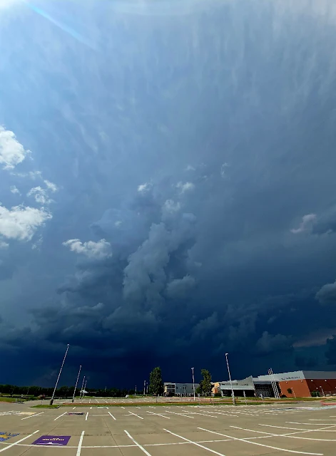
Mammatus clouds were visable showing the turbulence in the atmosphere.
We started seeming them shut down with high winds moving in the area.
We were late to the first funnels coming down and started watching several area start to fire up around us. The dryline started expanding and looking quite evil.
I did a quick panoramic of the area with the funnel on the right.
The cold front started clashing with the dryline and the cold front started building near Wichita.
The storm we were on started to back build and we were getting hail. I escaped to the south and found myself watching a funnel descend on the road in front of me.
Then it defined and touched down.
I was between the storm and the tornado which isn't a great place to be, but it moved off to the field left of me and cleared off the road.
This did hit a small structure and was listed as an EF1.
Then the storm got very scary. It rapidly unzipped between us and Wichita. During this time the Andover tornado began and we had essentially three different tornado warned areas between us and home. We made it. We're okay. And I'm a little late in posting this because I wanted some time for the news from Andover to settle down and luckily no one died with four minor injuries reported. This became a scary storm with me calling home and saying l, I don't know what's happening but get into shelter. We had high wind warnings in the area and some areas of blowing dust, but it was over quickly and we headed back home. 
It's been about 11 years since the Wichita area got hit and Reed Timer has some amazing footage from the Andover area if you want to look it up.
It was a mess of a storm and I decided to stop in Newton for some needed late supper and listened to an employee argue about wanting to go storm chasing in the dark.
 
I avoided the argument but should of said nope and explained why. The boss wasn't letting them go any way.
The storm continued east of Wichita with tornados near Eureka/Rosella area but I wanted to get home and listen about the damage in Andover. My phone and cameras were out of power anyway. So I write this and ponder on Monday. Another big setup for afternoon storms and will wait to see what it brings.
Stay safe. May could get ugly.

Sunday, June 23, 2019

06/22/2019 Lightning Study

There have been several storms as of late.  Last night, during our second series of storms, I took my daughter out to try to get some shots with the GoPro.  There are always shots that are missed.  The big one was to our west.  A large, positively-charged cloud to ground struck less than two miles from our location in the middle of our neighborhood.  Several firetrucks went out to the area looking for fires but as far as I know, were unable to find one.