Showing posts with label Kansas. Show all posts

Wednesday, May 6, 2026

April 23rd tornados and storms

 Life can be busy.  I'm writing this almost two weeks after the event due to other things I'm doing in my writing life and school.

April 23rd was an interesting day. 

I had a Professional Development day in Clearwater and the talk of the day was the storm chances we had.  I knew Oklahoma was under more threat, but had chasers all along I-35 waiting on the cap.

We actually got out early due to some people being a couple hours away and starting to panic that they would be driving in severe weather.  The late morning convective outlook moved us up to a moderate risk.


And the tornado threat increased for South Central Kansas on an advancing cold front/dryline triple point. 


There was a cap in Oklahoma limiting a lot of action down there, but the cap was beginning to erode.  There was a large number of chasers heading down south.  Storms were beginning to fire up on the cold front up North and I didn't want to go into Oklahoma more than a couple hours away.  I ended up heading into Canton, Kansas.

Inhave family that once maintained this graveyard and stopped by.

Storms were firing along the line and looking strong.

inwondered over to Marion then decided to head to Newton. The day reminded me a lot of the Andover tornado which dropped several tornadoes along the dry line and anchored with a powerful storm on the southern part.

I made it to Newton to a lot of cloud to ground lightning with what I thought was smoking. After hanging out for about 30 min I was about to call it quits when a certain area started smoking heavily near me. 

video

The tornado lasted about 8 minutes and only went through farm fields. I've been wanting to go back to the spot and do a drone survey but having time to do it hasn't worked out as much.

A nice little hailbow after.

I went back toward home and ended in one of my purches in Kechi doing lightning video.

Check out my YouTube channel for those.


Then it went cold. 40-50 degree mornings and light rain. Need more rain.

This has been the only tornado warning for the area this month and almost a week into May not seeing much else coming. 

Thursday, July 10, 2025

July 8th Severe Warned Storm

We ended up having the third wettest June. 11.5 inches roughly fell in the area getting Cheney Reservoir back to near normal levels. 

We had a slight risk for storms and a storm developed north of town. I wouldn't have known except I got a call from a friend wondering if it was safe to drive through. It was a slow moving summer pop up with some high tops on it and seemed very dark.

The storm powered up and the local NWS issues a severe thunderstorm warning for hail and high wind. 
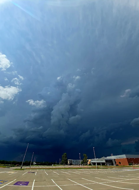
The wonky panoramic showed the anvil directly overhead.

The thunder was constant in this storm and showed areas of very heavy rain. 
There was a couple of areas of interest but nothing panned out.
I did just get the window replaced on the car and didn't want to chance much so I felt before it hit.


This is about two minutes of the soundscape, birds and thunder.


Thursday, June 19, 2025

Severe storms June 17th

 It's been a wet June.  All the spring rains seem to have come this month with a 5.5 inch day on June 3rd and 4th which caused significant flooding in my area.


Then this group of storms that hit, not once, not twice, but with three severe storms on June 17th. We were without power for 36 hours and have possibly lost two of our large trees.

This was the beginning of the wind.  Eisenhower Airport recorded a 102 mph wind gust 


The moment power went out in the area.
This was the main storm that caused damage in the area.  

Interesting enough, this was not the storm heavily warned about.  This was a derecho that came down from Nebraska.  There was another storm system that could cause more damage.

A little weather trough pushed by the previous storm's outflow gave a moderate area for storms.
I was on tree cleanup most of the day but around 5pm decided to run up to Newton to see an area that was developing.  An area near Wichita was coming in but a storm down south looked like it strengthened.


Harper, Kansas had a breif tornado 1 mile SSW of the city but I was a little late getting into the area.
This was on the back end of the storm.  Not sure if it was a microburst (strong winds were in the area) or a hail foot.
It dissipated quickly, and formed some fog from the area.  

An odd starship looking storm to the west looked interesting.

The air had cooled but it had a good groundscrubber with it.

Lots of positive stroke lightning out of both storms.  They seemed to pulse and look like they were getting their act together but neither produced.

One of the local guys stopped to see if I needed help, but recommended The Red Rooster Cafe in Harper for a good bite to eat.

The storm started to fall apart but found a great spot with birds chirping, but the cows were not having this storm nonsense. I would like to introduce the storm cows.


Monday, September 2, 2024

Cheney Lake at 60%


Cheney Lake is the reservoir that Wichita, Kansas draws its water from.  Wichita moved to Stage 2 drought restrictions on August 2, 2024 when the reservoir hit 70% of full.  These restrictions limit when residents can water yards.  

As of this weekend, Cheney Lake fell to 60%.  If the lake continues to drop, Stage 3 restrictions will begin at 50%

We have had rain this year and are doing better than one year ago at this time.  The problem is where the rain falls.  Below is from the US Drought Monitor.  


The estuaries that feed Cheney Lake (Mostly west of Wichita) have had a dry season and high temps.

This weekend, temps fell into the 80's and it was gorgeous.  Hopefully, we can have long, sustained rain back in the area.  Long range forecast only has one day with rain.

The pictures below are of Sailboat Cove.  As of this weekend, it was questionable if the main marina would be usable at Cheney and we didn't go by.