Friday, May 28, 2021

May 26th, 2021 tornado and storms

 A warm front draped along northern Kansas.  Lots of moisture hung around and the combination of the two caused severe storms to fire up western and central Kansas.  For several days the storm outlook talked about an energetic high atmosphere that promised large to giant-sized hail.  What interested me was the increase to 15% in the late afternoon convective outlook.  Deep layer shear (winds twisting with height) and increasing lower-level winds increased the tornado probability.

Due to school getting ready to be let out for the Summer, I had a rather late start.  The storms had already fired near Russel and a tornado had hit near Holyrood.  I decided to drive up to Lindsborg and go out west.  The storms were slow-moving only moving around 20-25 mph.  I made it to Kanopolis Lake and thought we were seeing funnels in the storm. 


The intense cloud-to-ground lightning started a couple fires.  The wall cloud did not produce anything and this storm ran out of power being cannibalized by a stronger storm to the west.  

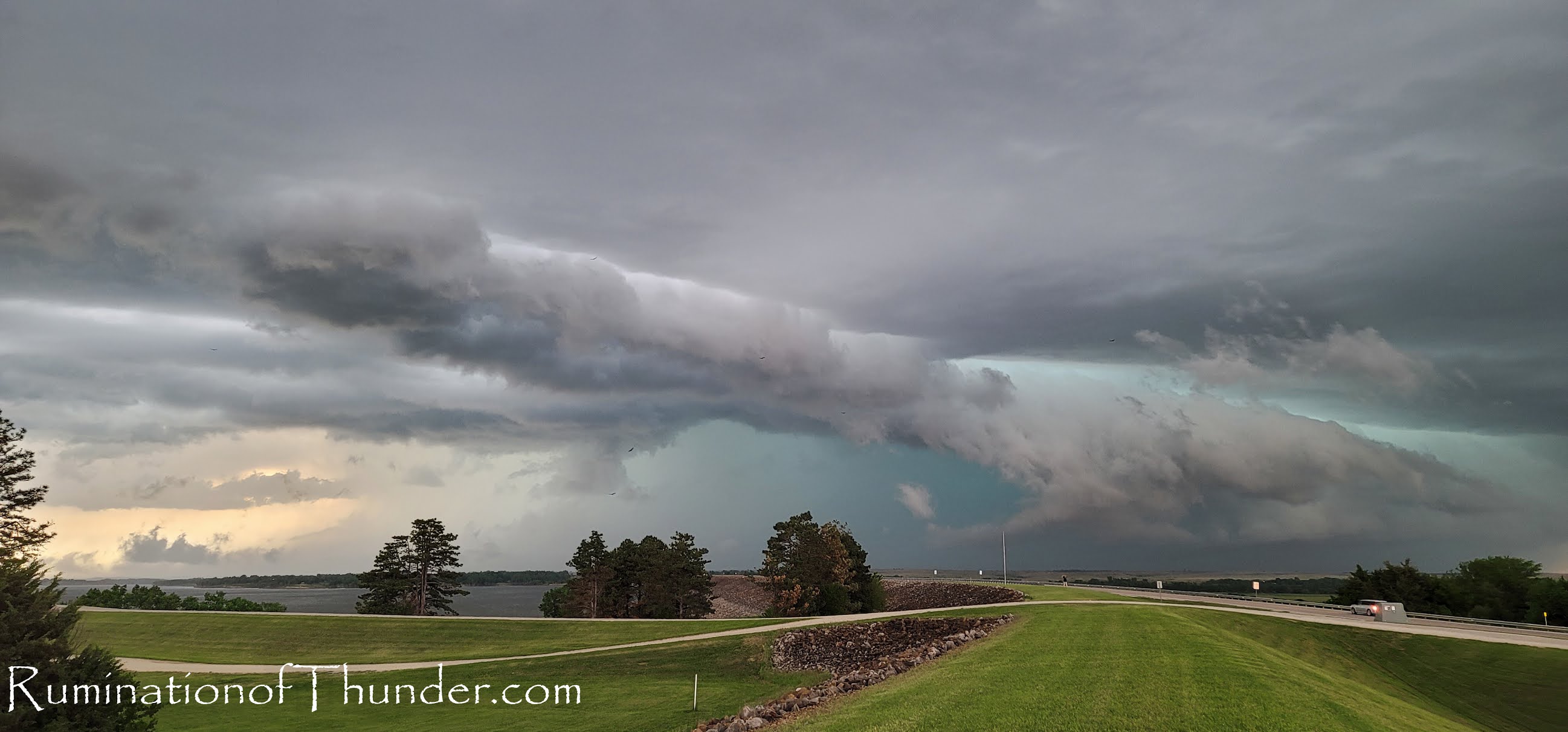
Being near Kanopolis Lake, we dropped in to get a couple photos near the water as the storm threatened to squall out.

My daughter grabbed the next couple of photos.


I ran down to the peer as the wind started to hit the lake.


We left the lake and headed to the brim of the lake.  Between lightning, we ran up and shot some quick shots.  

We ran to Geneseo as the 2nd storm was beginning to power up.  We dove south on K-14 and I started to see dust bloom.  We drove quickly as my daughter began shooting.  I saw the dust, but wasn't aware of the tornado until we drove past the dust.  I was able to get quickly past the spot and saw the funnel.  The national weather service said the tornado was only on the ground a 1/4 mile and rated it as an EF0.


We ended up a little closer to it than I wanted to be but quickly got south of the storm.  


We continued south through Lyons as the storm moved a little more southernly.  The town sounded their tornado sirens and we stopped at a couple places for a quick bite.  Most of the people were a little too freaked out by the sirens to give us food.  We went further south and watched the storm start to fall a part.  A lot of odd things happening where it looked like it was falling into a squal line.  Then condense into a wall cloud, then everything softened and fell apart.  We gave up on the storms and headed back towards town.  Ultimately it was a very busy weather day that ended the tornado drought

The end of May is here and we are probably going to start warming up quickly.  Chase season will probably be moving on soon.  As a note.  I recently started using my new phone for photos and have been pleasantly surprised with how well they have come out.  

Sunday, May 9, 2021

Storms May 8th, 2021

 Seems like the last several years, I always start my first blog of the year saying it's been a slow year.  It's been cooler, dry, ridges in the wrong place, but we've had some rain.  A frontal boundary set up some action for Kansas and it being a Saturday, I was able to chase.


They upgraded the convective outlook from slight to enhanced and the stage was set for north-central Kansas.    My daughter and I headed to Wilson, Kansas and hung out at Wilson Lake until the storms started to initiate.


We moved back to town and closer to I-70 to head toward any interesting popups.  The storms initiated and we had a good candidate to the east of us.  We headed toward Russel and pulled off in a couple of small towns to watch.


The storms were quickly showing mammatus clouds.
The storms went severe and we moved south out of Russel and followed.  One storm split, then absorbed another storm and became strong.

We stayed between two of the severe storms watching a couple areas of interest.

Down near Otis, Kansas, we started to see wall clouds forming.
A clear slot opened near the wall cloud, but nothing developed.
We started seeing good hail shafts coming out of the storm, and soon the dryline had crossed over limiting a lot of the severe potential and cutting the fuel from the storms.

The clouds started to fall apart and the storms more to the east became larger and more powerful.  

My daughter captured some great Meadowlarks and thunder, so I recorded this.  Please turn on the sound otherwise, it's a fairly boring video.


We headed back east with the storms decently ahead of us.  We stopped a couple times to capture some lightning and I may post those videos or captures later.  We started the long trek home with an incredible lightning show to the north and east of our location.  We made it home in time to see Saline County under a tornado warning, but only a funnel was spotted and at this time, there was no damage reported.

Hopefully we will see more storms this year, otherwise it's been fairly quiet.