Tuesday, July 6, 2021

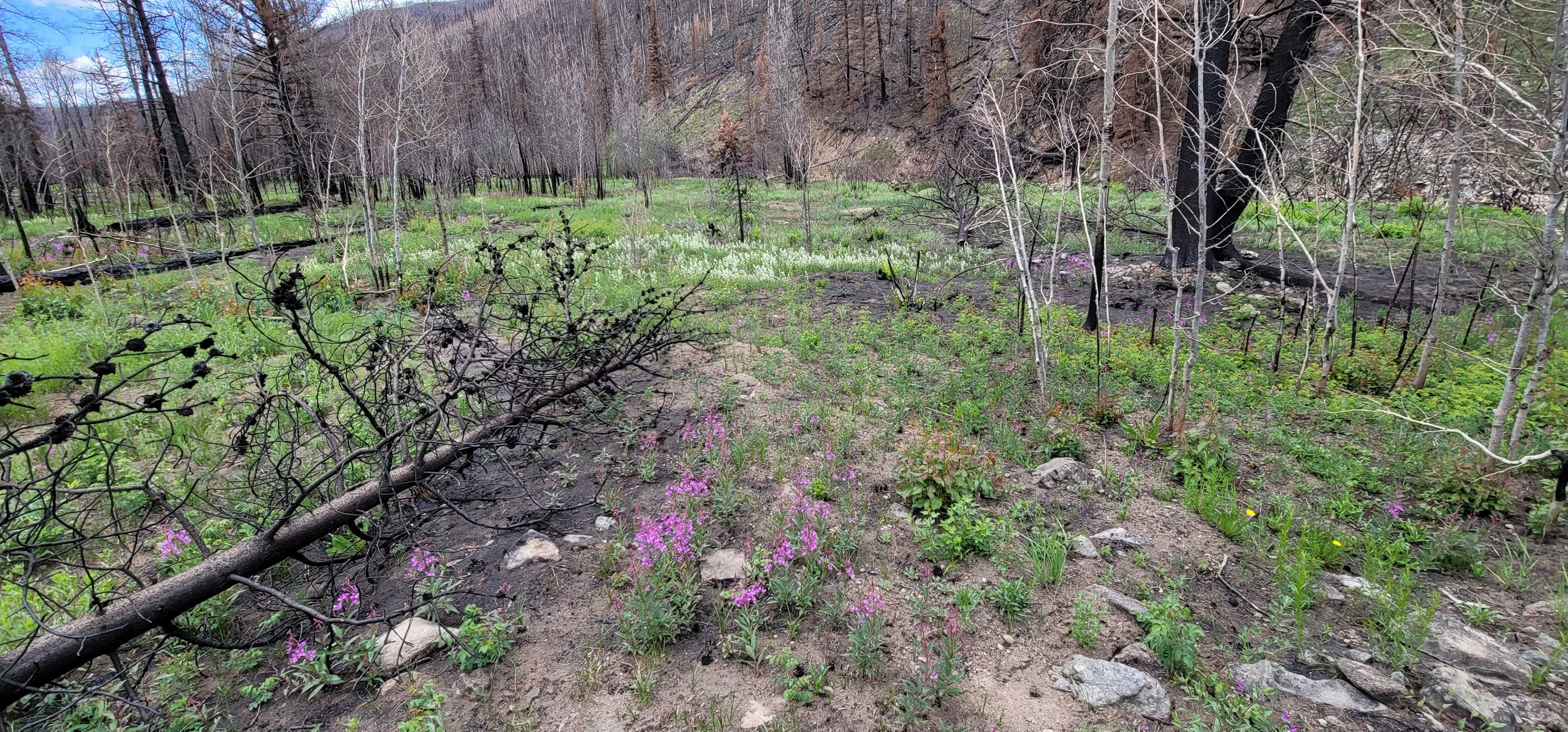
East Troublesome Fire Recovery Late June 2021

 The East Troublesome fire started on October 14th, 2020 northeast of Kimmerling, Colorado in the Arapaho National Forest.  The cause of the fire is still being investigated, but this fire became the 2nd most damaging wildfire in Colorado history. The fire claimed a total of 192,457 acres.  Due to low humidity, high winds (the worst day had gusts up to 60 mph), and fallen trees due to beetle infestation, the fire grew 120,000 acres in one day. making it the most rapid-fire expansion in state history.  

Arapaho National Park is still closed and they are currently in a recovery mode called the Emergency Stabilization-Burned Area Emergency Response (BAER).  This is where they will limit the run-off, soil erosion, and protect threatened species' environment.

 The fire nearly made it to the eastern side of Estes Park and to the eastern suburbs of Grand Lake.  Two people died in the Troublesome fire that refused to evacuate.  The fire was brought under control due to a winter storm that hit the area, increasing moisture in the area, cold weather, and lower winds.  Winter conditions greatly slowed the fire and it was 72% contained by November 19th.  By Thanksgiving of last year, the fire was not a threat to any communities.  In the end, over 400 houses and structures were destroyed.

While in Colorado we drove up Co-125 and documented what it looks like now.   While walking around, I found a pile of ashes that looked nearly identical to the soil, except there was no strength to it and my foot sunk down into the hole they covered. 

From https://www.cpr.org/2021/01/25/colorados-east-troublesome-wildfire-may-signal-a-new-era-of-big-fire-blow-ups/


Sorry for the long post.  

Citations 

https://coloradoencyclopedia.org/article/east-troublesome-fire

https://www.cpr.org/2021/01/25/colorados-east-troublesome-wildfire-may-signal-a-new-era-of-big-fire-blow-ups/

https://inciweb.nwcg.gov/incident/7242/


Fireworks

 Not too much weather to report on. A heavy storm hit a couple of weeks ago, but nothing else.  Found out my phone has super-slow motion, so here are some fireworks.


Friday, May 28, 2021

May 26th, 2021 tornado and storms

 A warm front draped along northern Kansas.  Lots of moisture hung around and the combination of the two caused severe storms to fire up western and central Kansas.  For several days the storm outlook talked about an energetic high atmosphere that promised large to giant-sized hail.  What interested me was the increase to 15% in the late afternoon convective outlook.  Deep layer shear (winds twisting with height) and increasing lower-level winds increased the tornado probability.

Due to school getting ready to be let out for the Summer, I had a rather late start.  The storms had already fired near Russel and a tornado had hit near Holyrood.  I decided to drive up to Lindsborg and go out west.  The storms were slow-moving only moving around 20-25 mph.  I made it to Kanopolis Lake and thought we were seeing funnels in the storm. 


The intense cloud-to-ground lightning started a couple fires.  The wall cloud did not produce anything and this storm ran out of power being cannibalized by a stronger storm to the west.  

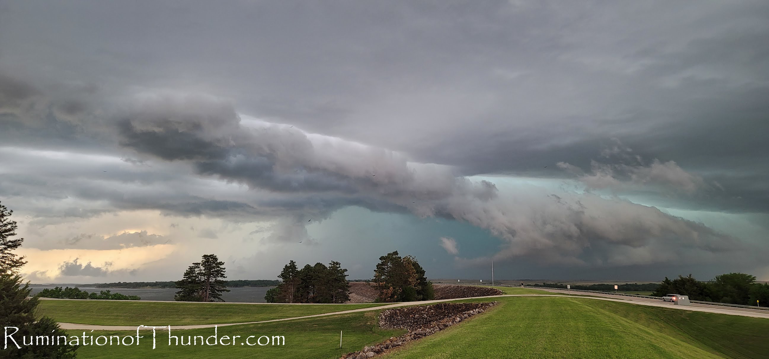
Being near Kanopolis Lake, we dropped in to get a couple photos near the water as the storm threatened to squall out.

My daughter grabbed the next couple of photos.


I ran down to the peer as the wind started to hit the lake.


We left the lake and headed to the brim of the lake.  Between lightning, we ran up and shot some quick shots.  

We ran to Geneseo as the 2nd storm was beginning to power up.  We dove south on K-14 and I started to see dust bloom.  We drove quickly as my daughter began shooting.  I saw the dust, but wasn't aware of the tornado until we drove past the dust.  I was able to get quickly past the spot and saw the funnel.  The national weather service said the tornado was only on the ground a 1/4 mile and rated it as an EF0.


We ended up a little closer to it than I wanted to be but quickly got south of the storm.  


We continued south through Lyons as the storm moved a little more southernly.  The town sounded their tornado sirens and we stopped at a couple places for a quick bite.  Most of the people were a little too freaked out by the sirens to give us food.  We went further south and watched the storm start to fall a part.  A lot of odd things happening where it looked like it was falling into a squal line.  Then condense into a wall cloud, then everything softened and fell apart.  We gave up on the storms and headed back towards town.  Ultimately it was a very busy weather day that ended the tornado drought

The end of May is here and we are probably going to start warming up quickly.  Chase season will probably be moving on soon.  As a note.  I recently started using my new phone for photos and have been pleasantly surprised with how well they have come out.